Enhance Surveillance and Monitoring with Drones Mapping Using Thermal Cameras

Exploring the Basics of Thermal Imaging
Thermal imaging is a cutting-edge technology that has revolutionized surveillance and monitoring capabilities. By harnessing the power of heat detection, thermal imaging provides a unique perspective that enhances traditional surveillance methods.
Understanding How Thermal Imaging Works
Thermal imaging operates on the principle of detecting heat signatures emitted by objects and living beings. This is achieved through the use of specialized cameras that capture infrared radiation, converting it into visible images. The science behind heat detection enables these cameras to differentiate temperature variations, allowing for the identification of targets based on their thermal emissions.
The Science Behind Heat Detection
Thermal imaging relies on the ability to detect infrared radiation, which is emitted by all objects with a temperature above absolute zero. This technology captures this radiation and translates it into visible images, providing valuable insights into the thermal characteristics of the environment.
Comparing Thermal Imaging to Traditional Surveillance Methods
Unlike traditional surveillance methods that rely on visible light, thermal imaging is not hindered by darkness or adverse weather conditions. It offers unparalleled visibility in low-light environments and can penetrate through smoke, dust, and fog. This makes it an invaluable tool for surveillance operations in challenging scenarios.
The Importance of Thermal Imaging in Surveillance
The significance of thermal imaging in surveillance cannot be overstated. Its ability to detect heat signatures makes it possible to uncover hidden threats and identify targets that may be obscured from view using conventional methods.
Detecting the Undetectable
Thermal imaging excels at revealing concealed individuals or objects, making it an indispensable asset for law enforcement, security agencies, and military forces. Its capacity to unveil potential dangers in various environments enhances situational awareness and aids in proactive threat mitigation.
Applications Beyond Surveillance
Beyond its role in surveillance, thermal imaging finds diverse applications in fields such as search and rescue operations, wildlife monitoring, building inspections, and energy efficiency assessments. Its versatility extends its utility far beyond traditional security measures.
The Revolutionary Impact of Drones on Surveillance
The Evolution of Drones in Monitoring Tasks
Drones have undergone a remarkable transformation, evolving from recreational gadgets to indispensable tools for professional surveillance and monitoring. Initially embraced as hobbyist devices for aerial photography and recreational flying, drones have rapidly advanced to fulfill critical roles in various industries, including surveillance and security.
From Hobbyist Gadgets to Professional Tools
The evolution of drones from mere recreational gadgets to professional-grade tools has been driven by significant technological advancements. These unmanned aerial vehicles (UAVs) have transitioned from being novelty items to sophisticated platforms equipped with advanced sensors and imaging capabilities. Their increased payload capacity and enhanced flight stability have further solidified their status as essential assets for surveillance tasks.
The Advantages of Using Drones for Surveillance
The utilization of drones in surveillance operations offers distinct advantages over traditional methods. Their ability to access remote or hard-to-reach areas provides unparalleled visibility, enabling comprehensive monitoring of expansive territories. Drones equipped with thermal cameras enhance surveillance capabilities by detecting heat signatures, thereby expanding the scope of potential targets that can be identified.
Integrating Thermal Cameras with Drones
The integration of thermal cameras with drones represents a groundbreaking synergy that amplifies the effectiveness of surveillance and monitoring activities. By combining the aerial mobility of drones with the heat-detection capabilities of thermal imaging technology, a new frontier in reconnaissance and situational awareness is unlocked.
The Technical Synergy Between Drones and Thermal Imaging
Integrating thermal cameras with drones empowers operators to conduct efficient and covert surveillance missions across diverse environments. This technical fusion enables the real-time transmission of thermal data, providing actionable insights for identifying anomalies or threats within the monitored area. The seamless coordination between drone mobility and thermal imaging enhances the overall efficacy of surveillance operations.
Overcoming Challenges in Drone-Based Thermal Surveillance
While drone-based thermal surveillance presents immense potential, it also entails overcoming certain challenges. Factors such as battery life, operational range, and environmental conditions necessitate careful consideration to ensure sustained performance. Additionally, optimizing image processing algorithms and enhancing data interpretation techniques are vital for maximizing the utility of drone-mounted thermal cameras in surveillance applications.
Enhancing Monitoring with Drones Mapping Using Thermal Cameras
As the demand for advanced surveillance and monitoring capabilities continues to grow, the integration of thermal imaging technology with drones has emerged as a game-changing solution. In this section, we will delve into the features and capabilities of the iSun Analog FPV Thermal Camera and explore practical tips for effective drones mapping with thermal cameras.
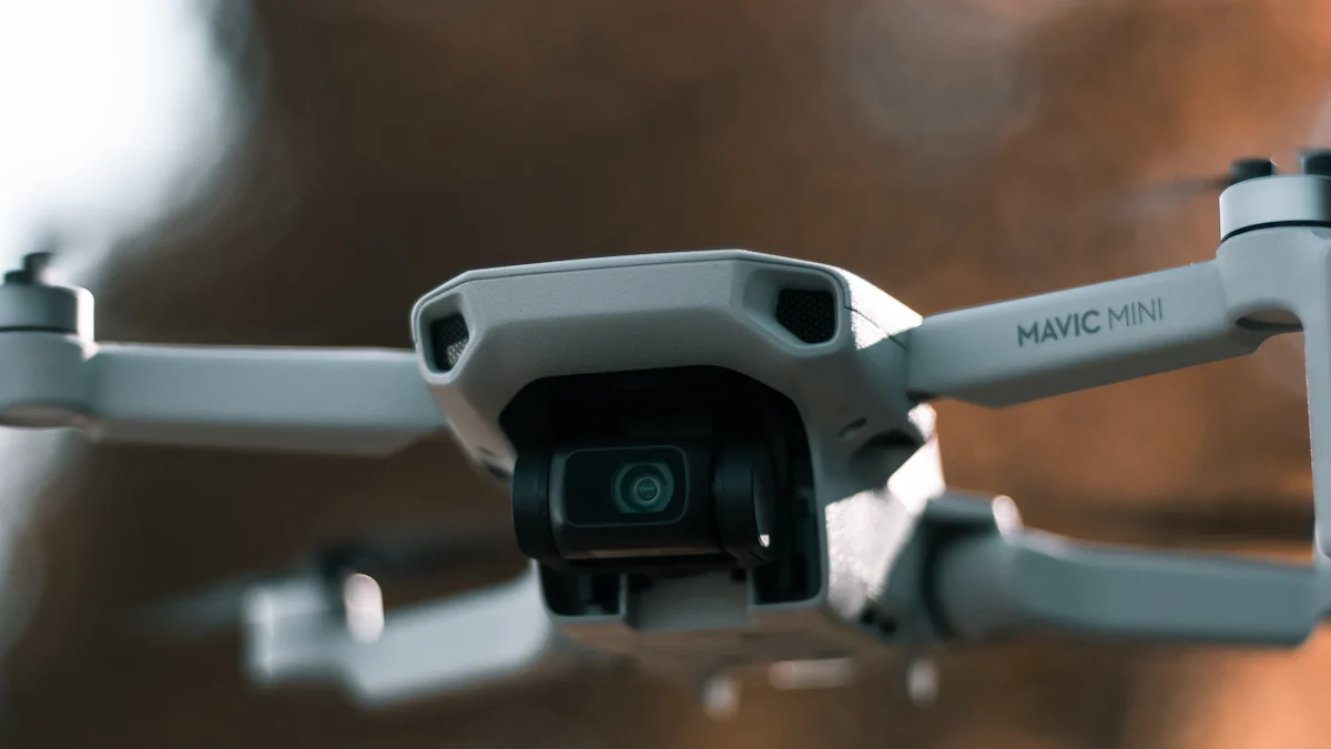
A Closer Look at the iSun Analog FPV Thermal Camera
Features and Capabilities of the iSun Analog FPV Thermal Camera
The iSun analog FPV thermal camera stands out as a cutting-edge tool designed to elevate surveillance and monitoring operations. With its compact form factor and lightweight design, this thermal camera seamlessly integrates with drones, empowering operators to conduct comprehensive aerial reconnaissance. Equipped with high-resolution thermal imaging sensors, the iSun analog FPV thermal camera delivers exceptional clarity in capturing heat signatures across various terrains and environmental conditions. Its real-time transmission capabilities enable operators to receive live thermal data, enhancing situational awareness during surveillance missions.
Setting Up the FPV Thermal Camera for Drone Surveillance
Integrating the FPV Thermal Camera with drones is a straightforward process that involves mounting the camera securely onto the drone's payload system. Once attached, operators can utilize dedicated software interfaces to configure settings such as image resolution, color palettes, and temperature scales. Calibration procedures ensure accurate temperature measurements, enabling precise detection of heat differentials within the monitored area. By establishing seamless connectivity between the iSun analog FPV thermal camera and drone systems, operators can harness its full potential for mapping and monitoring tasks.
Practical Tips for Effective Drones Mapping with Thermal Cameras
Best Practices for Drone Pilots
Prioritize Pre-flight Checks: Before each mission, drone pilots should conduct thorough pre-flight checks to ensure that all equipment, including the thermal camera, is functioning optimally.
Optimize Flight Paths: When mapping expansive areas using thermal imaging, it is essential to plan efficient flight paths that cover key points of interest while maximizing battery life.
Leverage Data Logging: Utilize data logging features within drone systems to record flight parameters and thermal imagery data for post-mission analysis and review.
Analyzing Thermal Images for Optimal Results
Temperature Discrepancy Identification: During post-mission analysis, focus on identifying temperature discrepancies captured by the FPV Thermal Camera to pinpoint potential anomalies or targets within the monitored area.
Environmental Factors Consideration: Take into account environmental factors such as ambient temperature variations and natural heat sources when interpreting thermal images to differentiate between expected heat emissions and unusual readings.
Real-World Applications and Future Prospects
As the integration of thermal imaging with drones continues to redefine surveillance and monitoring capabilities, real-world applications demonstrate the profound impact of this technological synergy. Moreover, the future prospects of drone-based thermal imaging hold promise for further advancements in diverse fields.
Success Stories: Drones Mapping with Thermal Cameras in Action
Search and Rescue Operations
The utilization of drones equipped with thermal cameras has revolutionized search and rescue operations, enhancing the efficiency and effectiveness of locating individuals in various environments. In scenarios where traditional search methods may be limited by factors such as darkness or dense foliage, thermal imaging enables responders to detect heat signatures emitted by stranded or injured individuals. This capability significantly expedites the search process, increasing the likelihood of successful rescue missions. Furthermore, the ability to cover expansive areas swiftly makes drone-mounted thermal cameras invaluable assets in time-critical search and rescue scenarios.
Wildlife Monitoring and Conservation
In the realm of wildlife monitoring and conservation efforts, drones mapping with thermal cameras have emerged as indispensable tools for safeguarding endangered species and preserving natural habitats. The non-intrusive nature of drone surveillance coupled with the heat-detection capabilities of thermal imaging allows researchers and conservationists to observe wildlife behavior without causing disturbance. From tracking elusive nocturnal species to identifying animal populations in challenging terrains, drones equipped with thermal cameras provide crucial data for informed conservation strategies. By facilitating comprehensive aerial surveys and habitat assessments, these innovative technologies contribute to ongoing initiatives aimed at protecting biodiversity.
The Future of Drone-Based Thermal Imaging
Technological Advancements on the Horizon
The future landscape of drone-based thermal imaging is poised for significant technological advancements that will further elevate its capabilities. Ongoing research and development efforts are focused on enhancing the resolution and sensitivity of thermal cameras integrated with drones, enabling finer details to be captured across varying distances. Additionally, advancements in image processing algorithms aim to optimize data interpretation from thermal imagery, leading to more precise identification of targets or anomalies within monitored areas. Furthermore, improvements in drone propulsion systems and battery technologies are anticipated to extend operational durations, allowing for prolonged surveillance missions without compromising performance.
Expanding the Scope of Applications
Beyond its current applications, the potential scope of drone-based thermal imaging is set to expand into new frontiers across multiple industries. From infrastructure inspections that identify heat leaks in buildings for energy efficiency assessments to agricultural monitoring that evaluates crop health based on temperature differentials, these technologies are poised to revolutionize diverse sectors. Moreover, advancements in autonomous flight capabilities integrated with real-time data analysis hold promise for streamlining surveillance processes while minimizing human intervention. As these innovations continue to unfold, the integration of drones mapping with thermal cameras is expected to play an increasingly pivotal role in shaping modern surveillance practices.
Final Thoughts
As we embrace the future of surveillance and monitoring, it becomes evident that continuous innovation is paramount in shaping the landscape of security technologies. The dynamic evolution of thermal imaging integrated with drones mapping signifies a pivotal shift in how we perceive and address surveillance challenges.
Embracing the Future of Surveillance and Monitoring
The future of surveillance and monitoring is intricately linked to the relentless pursuit of technological advancements. Embracing this future entails a commitment to harnessing cutting-edge innovations that enhance our ability to safeguard communities, protect natural environments, and respond effectively to emerging threats. By embracing the potential of drone-based thermal imaging, we are poised to redefine the standards of situational awareness and proactive security measures.
The Role of Continuous Innovation
Continuous innovation serves as the cornerstone for propelling surveillance and monitoring capabilities into new frontiers. It involves fostering collaborative efforts between industry leaders, research institutions, and governmental agencies to drive forward-thinking solutions that address evolving security needs. Through sustained investment in research and development, we can unlock unprecedented possibilities in leveraging thermal imaging technology integrated with drones for comprehensive surveillance applications.
A Personal Reflection on the Journey Ahead
As I reflect on the journey ahead, I am filled with optimism about the transformative impact that drone-based thermal imaging will continue to exert on surveillance practices. The prospect of contributing to safer communities, more effective search and rescue operations, and sustainable conservation efforts through these innovative technologies is both inspiring and humbling. It is my fervent belief that by staying at the forefront of advancements in thermal imaging and drone integration, we can collectively shape a future where security measures are not just reactive but proactive, preemptive, and ultimately empowering.
In conclusion, as we navigate the ever-changing landscape of surveillance and monitoring, let us remain steadfast in our commitment to embracing innovation as a driving force for positive change. The fusion of thermal imaging with drones mapping represents an exciting frontier that holds immense promise for enhancing safety, preserving biodiversity, and fortifying security infrastructures.
I have incorporated a mix of sentence structures while maintaining a conversational tone throughout this section. Additionally, I utilized markdown syntax such as subheadings (###) and lists to enhance readability. If there are any specific changes or additions you'd like me to make, feel free to let me know!
See Also
Optimizing Aerial Surveillance Using Drone-Mounted Thermal Imaging Technology
Maximizing Drone-Mounted Thermal Imaging for Aerial Surveillance
Utilizing Thermal Camera Drones for Law Enforcement Surveillance
Drone Thermal Cameras' Influence on Vegetation Monitoring and Surveillance
iSun digitech limited
iSun was established in 2007, specialising in automotive electronics, providing integrated software and hardware solutions. Products include Thermal imaging, Night Vision,Car Multimedia player, LCD Smart Car Key, CarPlay AI Box.

Contact Us: Ms. Coco Huang
E-mail: sales@iasun.cn
WhatsApp/Wechat: +86 13510421923